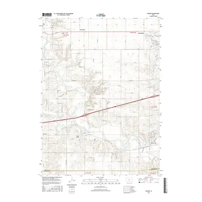
2015 Map of Waukee
USGS Topo · Published 2015About this map
The North Raccoon River and South Raccoon River converge in this section of Dallas County, shaping a landscape defined by well-established rural townships and growing river towns. Modern transportation corridors, including the Interstate 80 crossing, now bisect land once defined by the early settlements of Van Meter and Booneville. Genealogists will find several notable burial sites preserved across the countryside, such as the Odd Fellows Cem near Adel and the Thornton Cem situated between the river forks.
Find a feature on this map
90 named features on this map. Tap any name to fly to it.
Don’t see what you’re looking for? This feature index may not catch every label — zoom into the map to look around manually.
Map Details
Editions of this 2015 Waukee Map
This is the sole edition of this map. No revisions or reprints were ever made.
Other maps of this area

1908 · Waukee
USGS Topo · 1:62,500

1949 · Adel
USGS Topo · 1:62,500

1951 · Adel
USGS Topo · 1:62,500

1951 · St. Charles
USGS Topo · 1:62,500

1952 · Winterset
USGS Topo · 1:62,500

1954 · Omaha
USGS Topo · 1:250,000

1954 · Des Moines
USGS Topo · 1:250,000

1956 · Des Moines
USGS Topo · 1:250,000

1957 · Des Moines
USGS Topo · 1:250,000

1957 · Omaha
USGS Topo · 1:250,000