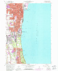
2024 Map of Waukegan
USGS Topo · Published 2024About this map
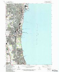
Lake Michigan forms the eastern boundary of this densely developed Lake County corridor, where the industrial and civic heart of Waukegan meets the specialized military and educational zones of North Chicago. The map documents a complex urban landscape where the Lake County Courthouse and College of Lake County Lakeshore Campus anchor the city center near Waukegan Harbor. Moving south, the terrain transition from the mouth of the Waukegan River toward the significant coastal footprint of Navsta Station illustrates the area's long-standing connection to maritime and naval operations.
Find a feature on this map
81 named features on this map. Tap any name to fly to it.
Don’t see what you’re looking for? This feature index may not catch every label — zoom into the map to look around manually.
Map Details
Editions of this 2024 Waukegan Map
This is the sole edition of this map. No revisions or reprints were ever made.
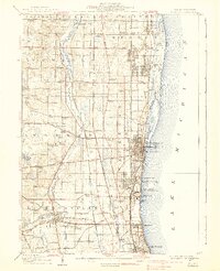
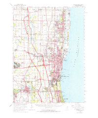
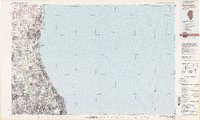
Historical Maps of Nimitz Village Through Time
8 maps found