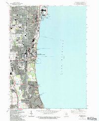
1993 Map of Waukegan
USGS Topo · Published 1993About this map
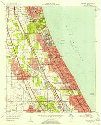
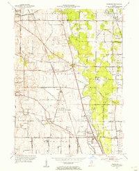
The massive Great Lakes Naval Training Center dominates the shoreline of Lake Michigan in this early 1990s depiction of the Lake County coast. The map illustrates a dense corridor of civic and educational infrastructure stretching from Waukegan south through North Chicago and into Lake Forest. This period shows a complex landscape of industrial and institutional use, featuring the expansive Downey VA Hospital and the Chicago Medical Sch. The residential and commercial growth is framed by established landmarks like Oakwood Cemetery and the historic Sheridan Road. Inland, the terrain is shaped by the County Forest Preserve and recreational spaces such as the numerous Golf Courses that define the suburban character of Lake Bluff. This survey documents the region's late-century urban layout, including the rail activity at Skokie Junction and the harbor operations at Waukegan Harbor.
Find a feature on this map
56 named features on this map. Tap any name to fly to it.
Don’t see what you’re looking for? This feature index may not catch every label — zoom into the map to look around manually.
Map Details
Editions of this 1993 Waukegan Map
This is the sole edition of this map. No revisions or reprints were ever made.
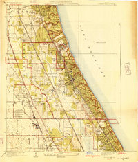
Other maps of this area

1899 · Evanston
USGS Topo · 1:62,500

1900 · Highwood
USGS Topo · 1:62,500

1906 · Waukegan
USGS Topo · 1:62,500

1908 · Waukegan
USGS Topo · 1:62,500
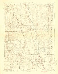
1928 · Wheeling
USGS Topo · 1:24,000
1928 · Highland Park
USGS Topo · 1:24,000
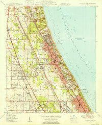
1951 · Highland Park
USGS Topo · 1:24,000
1953 · Highland Park
USGS Topo · 1:24,000
1953 · Wheeling
USGS Topo · 1:24,000

1958 · Racine
USGS Topo · 1:250,000