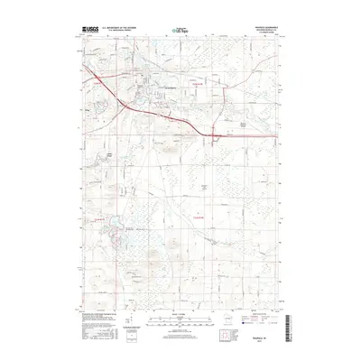
2015 Map of Waupaca
USGS Topo · Published 2015About this map
Waupaca serves as the central hub of this Wisconsin landscape, where the Waupaca River and Waupaca Millpond define the town's northern character. The area is dense with water bodies and wetlands, ranging from the cluster of small lakes near King to the more isolated Spencer Lake and McAllister Lake further south. Genealogists and local researchers will find several notable burial sites throughout the region, including Saint Mary Magdalene Cem and the Lakeside Memorial Park near Shadow Lake. The terrain transitions from the developed streets of the city to the more open spaces of the High Point Ridge and the winding course of Walla Walla Cr. Infrastructure like the Waupaca Municipal Airport and the Northern Lite Airport provide modern landmarks alongside the traditional rural settlement of Little Hope.
Find a feature on this map
122 named features on this map. Tap any name to fly to it.
Don’t see what you’re looking for? This feature index may not catch every label — zoom into the map to look around manually.
Map Details
Editions of this 2015 Waupaca Map
This is the sole edition of this map. No revisions or reprints were ever made.
Other maps of this area

1955 · Green Bay
USGS Topo · 1:250,000

1956 · Weyauwega
USGS Topo · 1:48,000

1957 · Waupaca
USGS Topo · 1:48,000

1961 · Poy Sippi
USGS Topo · 1:62,500

1961 · Redgranite
USGS Topo · 1:62,500

1961 · Saxeville
USGS Topo · 1:24,000

1961 · Wild Rose
USGS Topo · 1:24,000
1961 · Poy Sippi
USGS Topo · 1:24,000
1969 · Manawa
USGS Topo · 1:24,000
1969 · Weyauwega
USGS Topo · 1:24,000