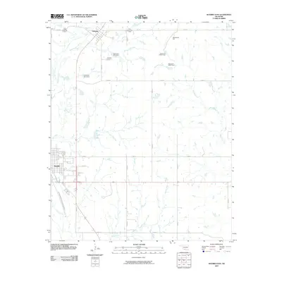
2009 Map of Waurika East
USGS Topo · Published 2009About this map
Addington stands as a primary settlement in this Jefferson County landscape, characterized by a complex network of tributaries and modern water management features. The area is defined by the winding paths of Cow Creek and Beaver Creek, with numerous flood control structures such as Cow Creek Site 2 Dam and Cow Creek Site 47 Dam scattered across the drainage basin. These engineered dams, alongside others like the uniquely designated Oknoname 067012 Dam, illustrate the 21st-century efforts to regulate the seasonal flow of the region's intermittent streams.
Find a feature on this map
28 named features on this map. Tap any name to fly to it.
Don’t see what you’re looking for? This feature index may not catch every label — zoom into the map to look around manually.
Map Details
Editions of this 2009 Waurika East Map
This is the sole edition of this map. No revisions or reprints were ever made.
Other maps of this area

1901 · Addington
USGS Topo · 1:125,000

1955 · Lawton
USGS Topo · 1:250,000

1957 · Hastings
USGS Topo · 1:62,500

1957 · Ardmore
USGS Topo · 1:250,000

1962 · Ryan
USGS Topo · 1:62,500

1962 · Temple
USGS Topo · 1:62,500

1963 · Ardmore
USGS Topo · 1:250,000

1964 · Comanche SE
USGS Topo · 1:24,000

1964 · Comanche
USGS Topo · 1:24,000
1984 · Irving
USGS Topo · 1:24,000