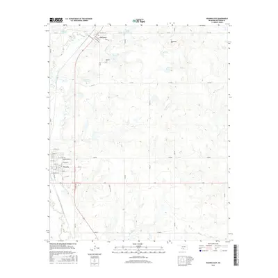
2016 Map of Waurika East
USGS Topo · Published 2016About this map
The settlement of Waurika occupies the southwestern portion of this Jefferson County landscape, where a grid of residential streets including E Broadway Ave and George Brown St meet the primary north-south transit corridor. Further north, the smaller community of Addington sits near the Addington Cem, serving as a localized hub for the surrounding ranchlands and agricultural operations. The terrain is defined by a sophisticated water management system, characterized by a series of numbered reservoirs such as Cow Cr Site 2 Reservoir and Cow Cr Site 5 Reservoir which control the flow of Cow Cr. This network of basins and creeks, including Beaver Cr and W Mud Cr, highlights the region's reliance on water conservation for its rural economy. Notable landmarks like Monument Hill provide elevation reference points above the winding paths of Squirrel Cr and Monument Cr.
Find a feature on this map
50 named features on this map. Tap any name to fly to it.
Don’t see what you’re looking for? This feature index may not catch every label — zoom into the map to look around manually.
Map Details
Editions of this 2016 Waurika East Map
This is the sole edition of this map. No revisions or reprints were ever made.
Other maps of this area

1901 · Addington
USGS Topo · 1:125,000

1955 · Lawton
USGS Topo · 1:250,000

1957 · Hastings
USGS Topo · 1:62,500

1957 · Ardmore
USGS Topo · 1:250,000

1962 · Ryan
USGS Topo · 1:62,500

1962 · Temple
USGS Topo · 1:62,500

1963 · Ardmore
USGS Topo · 1:250,000

1964 · Comanche SE
USGS Topo · 1:24,000

1964 · Comanche
USGS Topo · 1:24,000
1984 · Irving
USGS Topo · 1:24,000