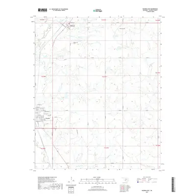
2018 Map of Waurika East
USGS Topo · Published 2018About this map
Waurika and Addington anchor this survey of Jefferson County, where the plains are defined by an intricate network of tributaries and managed water systems. The landscape is marked by the presence of numerous small-scale water management projects, including Cow Cr Site 5 Reservoir and Cow Cr Site 3 Reservoir, which speak to the area's agricultural and conservation needs. These reservoirs dot the drainages of Cow Creek, Monument Creek, and West Mud Creek.
Find a feature on this map
54 named features on this map. Tap any name to fly to it.
Don’t see what you’re looking for? This feature index may not catch every label — zoom into the map to look around manually.
Map Details
Editions of this 2018 Waurika East Map
This is the sole edition of this map. No revisions or reprints were ever made.
Other maps of this area

1901 · Addington
USGS Topo · 1:125,000

1955 · Lawton
USGS Topo · 1:250,000

1957 · Hastings
USGS Topo · 1:62,500

1957 · Ardmore
USGS Topo · 1:250,000

1962 · Ryan
USGS Topo · 1:62,500

1962 · Temple
USGS Topo · 1:62,500

1963 · Ardmore
USGS Topo · 1:250,000

1964 · Comanche SE
USGS Topo · 1:24,000

1964 · Comanche
USGS Topo · 1:24,000
1984 · Irving
USGS Topo · 1:24,000