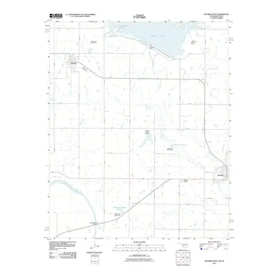
2010 Map of Waurika West
USGS Topo · Published 2010About this map
The Red River defines the southern boundary of this Oklahoma landscape, where the confluence of several major tributaries shapes the local geography. Significant water management infrastructure is evident throughout the quadrangle, notably the large Waurika Lake and its associated Waurika Dam. Further south, the Oknoname 067002 Reservoir and the Japanese Beaver Lake Dam illustrate the complex network of small reservoirs and dams built to control the flow of Beaver Creek and its branches as they move toward the Texas border.
Find a feature on this map
34 named features on this map. Tap any name to fly to it.
Don’t see what you’re looking for? This feature index may not catch every label — zoom into the map to look around manually.
Map Details
Editions of this 2010 Waurika West Map
This is the sole edition of this map. No revisions or reprints were ever made.
Other maps of this area

1901 · Addington
USGS Topo · 1:125,000

1955 · Lawton
USGS Topo · 1:250,000

1957 · Hastings
USGS Topo · 1:62,500

1957 · Ardmore
USGS Topo · 1:250,000

1962 · Ryan
USGS Topo · 1:62,500

1962 · Temple
USGS Topo · 1:62,500

1963 · Ardmore
USGS Topo · 1:250,000

1964 · Comanche
USGS Topo · 1:24,000

1984 · Hooper
USGS Topo · 1:24,000
1984 · Irving
USGS Topo · 1:24,000