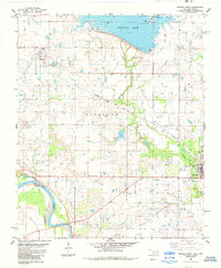
1984 Map of Waurika West
USGS Topo · Published 1985About this map
The Waurika Lake reservoir dominates the northern landscape of this Jefferson County region, where the Beaver Creek drainage meets the town of Waurika. This 1980s-era survey documents a landscape of water management and transportation, featuring an extensive aqueduct system and several public recreation areas including Moneka Park and Kiowa Park No 2. Further west, the town of Hastings is detailed alongside its local infrastructure, including several Water Tanks.
Find a feature on this map
28 named features on this map. Tap any name to fly to it.
Don’t see what you’re looking for? This feature index may not catch every label — zoom into the map to look around manually.
Map Details
Editions of this 1984 Waurika West Map
This is the sole edition of this map. No revisions or reprints were ever made.
Other maps of this area

1901 · Addington
USGS Topo · 1:125,000

1955 · Lawton
USGS Topo · 1:250,000

1957 · Hastings
USGS Topo · 1:62,500

1957 · Ardmore
USGS Topo · 1:250,000

1962 · Ryan
USGS Topo · 1:62,500

1962 · Temple
USGS Topo · 1:62,500

1963 · Ardmore
USGS Topo · 1:250,000

1964 · Comanche
USGS Topo · 1:24,000

1984 · Hooper
USGS Topo · 1:24,000
1984 · Irving
USGS Topo · 1:24,000