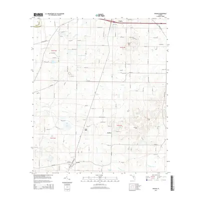
2015 Map of Wausau
USGS Topo · Published 2015About this map
Wausau and the surrounding agricultural landscape of Washington County are documented in this 2015 study, which highlights a network of small settlements and local industry. The map captures the geographic distribution of community life at Bells Mill and Bradford, while also identifying Orange Hill and its namesake Orange Hill Airport. The terrain is defined by a dense system of waterways, including the winding Holmes Cr on the western edge and several branches of Hard Labor Cr that drain the central and southern sections. Cultural landmarks such as Everett Cem and the distinctive Falling Water Hill provide points of reference for local historians. This survey effectively illustrates the persistent rural character of the region, where family-named roads like Douglas Ferry Rd and Peel Rd connect scattered residences and ponds such as Owens Lake and Corbin Pond.
Find a feature on this map
75 named features on this map. Tap any name to fly to it.
Don’t see what you’re looking for? This feature index may not catch every label — zoom into the map to look around manually.
Map Details
Editions of this 2015 Wausau Map
This is the sole edition of this map. No revisions or reprints were ever made.
Other maps of this area

1950 · Vernon
USGS Topo · 1:24,000

1950 · Chipley
USGS Topo · 1:24,000

1950 · Wausau
USGS Topo · 1:24,000

1950 · Gap Lake
USGS Topo · 1:24,000

1950 · Poplar Head
USGS Topo · 1:24,000

1951 · Chipley
USGS Topo · 1:24,000

1951 · Wausau
USGS Topo · 1:24,000
1951 · Poplar Head
USGS Topo · 1:24,000

1951 · Bonifay
USGS Topo · 1:24,000

1951 · Gap Pond
USGS Topo · 1:24,000