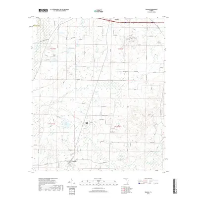
2018 Map of Wausau
USGS Topo · Published 2018About this map
The town of Wausau and the community of Orange Hill anchor this Washington County landscape, which transitions between elevated pinelands and low-lying wetland basins. Near the northern boundary, Falling Water State Park highlights the unique geology of the area around Falling Water Hill, where drainage patterns create distinctive features such as Falling Water. The map documents a rural network of named bays and ponds, including Sand Hill Bay and Owens Lake, which have long influenced the placement of early settlements and industry.
Find a feature on this map
121 named features on this map. Tap any name to fly to it.
Don’t see what you’re looking for? This feature index may not catch every label — zoom into the map to look around manually.
Map Details
Editions of this 2018 Wausau Map
This is the sole edition of this map. No revisions or reprints were ever made.
Other maps of this area

1950 · Vernon
USGS Topo · 1:24,000

1950 · Chipley
USGS Topo · 1:24,000

1950 · Wausau
USGS Topo · 1:24,000

1950 · Gap Lake
USGS Topo · 1:24,000

1950 · Poplar Head
USGS Topo · 1:24,000

1951 · Chipley
USGS Topo · 1:24,000

1951 · Wausau
USGS Topo · 1:24,000
1951 · Poplar Head
USGS Topo · 1:24,000

1951 · Bonifay
USGS Topo · 1:24,000

1951 · Gap Pond
USGS Topo · 1:24,000