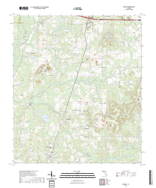
2024 Map of Wausau
USGS Topo · Published 2024About this map
Wausau and the surrounding Florida Panhandle landscape are defined by a network of creeks and numerous small basins like Smutty Bay and Cobb Bay. This survey captures the rural character of Washington County, where community life centers on established sites like Bells Mill and Bradford. The region's history is preserved through its many denominational and family landmarks, including Shiloh Baptist Church and the Saint Joseph A M E Church. To the north, the terrain rises toward Falling Water Hill, while the lowlands are drained by Hard Labor Creek and Holmes Creek. These watercourses were vital for early settlement and small-scale industry, as evidenced by the namesake Jones Rice Mill Branch and Brock Mill Branch. Genealogists will find a high density of burial sites documented, from the Wausau Memorial Gardens Cem to smaller plots like Piney Grove Cem West.
Find a feature on this map
131 named features on this map. Tap any name to fly to it.
Don’t see what you’re looking for? This feature index may not catch every label — zoom into the map to look around manually.
Map Details
Editions of this 2024 Wausau Map
This is the sole edition of this map. No revisions or reprints were ever made.
Other maps of this area

1950 · Vernon
USGS Topo · 1:24,000

1950 · Chipley
USGS Topo · 1:24,000

1950 · Wausau
USGS Topo · 1:24,000

1950 · Gap Lake
USGS Topo · 1:24,000

1950 · Poplar Head
USGS Topo · 1:24,000

1951 · Chipley
USGS Topo · 1:24,000

1951 · Wausau
USGS Topo · 1:24,000
1951 · Poplar Head
USGS Topo · 1:24,000

1951 · Bonifay
USGS Topo · 1:24,000

1951 · Gap Pond
USGS Topo · 1:24,000