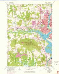
1963 Map of Wausau West
USGS Topo · Published 1978About this map
Rib Mountain dominates the center of this mid-century survey, with its summit marked by Radio Towers and the surrounding Rib Mountain State Park. The landscape transition is sharp where the high ground meets the meanders of the Big Rib River and the industrial corridors of the Wisconsin River. In the east, the urban expansion of Wausau is shown in detail, including its extensive educational infrastructure from the Technical Institute to local parochial schools like St Anne Sch.
Find a feature on this map
64 named features on this map. Tap any name to fly to it.
Don’t see what you’re looking for? This feature index may not catch every label — zoom into the map to look around manually.
Map Details
Editions of this 1963 Wausau West Map
2 editions found

Other maps of this area

1899 · Wausau
USGS Topo · 1:125,000

1902 · Wausau
USGS Topo · 1:125,000

1902 · Marathon
USGS Topo · 1:125,000

1951 · Merrill
USGS Topo · 1:48,000

1951 · Hamburg
USGS Topo · 1:48,000

1953 · Wausau
USGS Topo · 1:48,000

1953 · Marathon
USGS Topo · 1:48,000

1954 · Iron Mountain
USGS Topo · 1:250,000

1955 · Green Bay
USGS Topo · 1:250,000

1959 · Iron Mountain
USGS Topo · 1:250,000