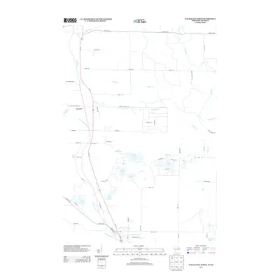
2013 Map of Wausaukee North
USGS Topo · Published 2013About this map
The Pike River and its cascading Daves Falls define the northern reaches of this landscape in Marinette County, where water systems dictate the pattern of human settlement. The small community of Cedarville sits at the junction of Us-141 and Amberg Wausaukee Rd, serving as a central point for the surrounding network of rural roads such as Barker Rd and Kaiko Rd. To the south, the terrain becomes increasingly lacustrine, dotted with numerous small bodies of water including Island Lake, Little Island Lake, and Grass Lake. The presence of the Bible Camp near Helen Lake suggests the area's continued role as a site for seasonal recreation and community gathering. The map also traces the winding course of the Wausaukee River as it approaches its confluence with the Menominee River, illustrating the complex drainage of the Wisconsin-Michigan borderlands.
Find a feature on this map
61 named features on this map. Tap any name to fly to it.
Don’t see what you’re looking for? This feature index may not catch every label — zoom into the map to look around manually.
Map Details
Editions of this 2013 Wausaukee North Map
This is the sole edition of this map. No revisions or reprints were ever made.
Other maps of this area

1939 · Pembine
USGS Topo · 1:48,000

1939 · Dunbar
USGS Topo · 1:48,000

1940 · Athelstane
USGS Topo · 1:48,000

1941 · Dunbar
USGS Topo · 1:48,000

1942 · Athelstane
USGS Topo · 1:48,000

1942 · Wausaukee
USGS Topo · 1:48,000

1947 · Pembine
USGS Topo · 1:48,000

1947 · Dunbar
USGS Topo · 1:48,000

1947 · Wausaukee
USGS Topo · 1:48,000

1954 · Iron Mountain
USGS Topo · 1:250,000