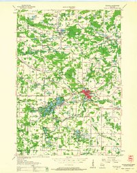
1959 Map of Wautoma
USGS Topo · Published 1961About this map
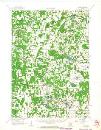
Glacial kettle lakes and winding river systems dominate this late-1950s landscape of Waushara County. Wautoma serves as a central hub, featuring a Drive-in Theater, Fairgrounds, and an early Landing Field, while the Chicago and North Western railroad corridor links the smaller settlements of Plainfield and Wild Rose. The map reveals a dense network of rural infrastructure, from the Willow Grove Sch and Tamarack Sch to numerous local burial grounds like North Deerfield Cem and Fish Lake Cem. Waterways such as the Mecan River and Pine River cut through the undulating terrain, punctuated by the White River Flowage and dozens of named lakes including Lake Wautoma, Long Lake, and Marl Lake. The distribution of Gravel Pits and Marl Pits across the townhips suggests the geological and economic activities of the era.
Find a feature on this map
81 named features on this map. Tap any name to fly to it.
Don’t see what you’re looking for? This feature index may not catch every label — zoom into the map to look around manually.
Map Details
Editions of this 1959 Wautoma Map
This is the sole edition of this map. No revisions or reprints were ever made.
Other maps of this area

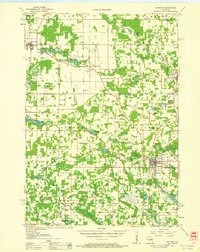
1915 · Neshkoro
USGS Topo · 1:48,000
1918 · Neshkoro
USGS Topo · 1:62,500

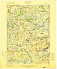
1955 · Green Bay
USGS Topo · 1:250,000
1957 · Amherst
USGS Topo · 1:48,000
1957 · Waupaca
USGS Topo · 1:48,000

1957 · Whiting
USGS Topo · 1:48,000

1957 · Madison
USGS Topo · 1:250,000

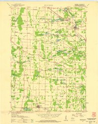
1958 · Coloma
USGS Topo · 1:48,000

1960 · Madison
USGS Topo · 1:250,000
1961 · Oxford
USGS Topo · 1:62,500