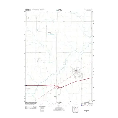
2011 Map of Waverly
USGS Topo · Published 2011About this map
Waverly and its surrounding agricultural landscape appear here in the early 21st century, defined by the winding course of Salt Creek and its many tributaries. The area shows a transition between the established town center—home to the Waverly Post Office and Waverly Cemetery—and the developing rural tracts to the west and south. This survey documents the critical water management infrastructure of the region, including the Snyder Dam and Sponheimer Dam, which create reservoirs that punctuate the prairie drainage system. To the south, the Marian Center and Pierce Cemetery stand as quiet landmarks among a grid of farm-to-market roads like McKelvie Rd and Alvo Rd. The presence of the Hall-Feld Airport in the northwest corner highlights the local aviation footprint within this Nebraska landscape of creek beds and reservoirs.
Find a feature on this map
32 named features on this map. Tap any name to fly to it.
Don’t see what you’re looking for? This feature index may not catch every label — zoom into the map to look around manually.
Map Details
Editions of this 2011 Waverly Map
This is the sole edition of this map. No revisions or reprints were ever made.
Other maps of this area

1893 · Fremont
USGS Topo · 1:125,000

1896 · Fremont
USGS Topo · 1:125,000

1897 · Lincoln
USGS Topo · 1:125,000

1899 · Wahoo
USGS Topo · 1:125,000

1903 · Weeping Water
USGS Topo · 1:125,000

1929 · Weeping Water
USGS Topo · 1:125,000

1955 · Fremont
USGS Topo · 1:250,000

1955 · Lincoln
USGS Topo · 1:250,000

1957 · Fremont
USGS Topo · 1:250,000

1957 · Lincoln
USGS Topo · 1:250,000