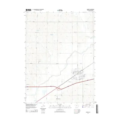
2014 Map of Waverly
USGS Topo · Published 2014About this map
Waverly serves as the primary hub of this eastern Nebraska landscape, where residential expansion is clearly visible in the burgeoning street grid south of the Salt Cr valley. Modern thoroughfares like Waverly Rd and Bluff Rd connect the town to the surrounding agricultural uplands, which are deeply dissected by a network of drainage ways including Millville Cr, Rock Cr, and Jordan Cr.
Find a feature on this map
32 named features on this map. Tap any name to fly to it.
Don’t see what you’re looking for? This feature index may not catch every label — zoom into the map to look around manually.
Map Details
Editions of this 2014 Waverly Map
This is the sole edition of this map. No revisions or reprints were ever made.
Other maps of this area

1893 · Fremont
USGS Topo · 1:125,000

1896 · Fremont
USGS Topo · 1:125,000

1897 · Lincoln
USGS Topo · 1:125,000

1899 · Wahoo
USGS Topo · 1:125,000

1903 · Weeping Water
USGS Topo · 1:125,000

1929 · Weeping Water
USGS Topo · 1:125,000

1955 · Fremont
USGS Topo · 1:250,000

1955 · Lincoln
USGS Topo · 1:250,000

1957 · Fremont
USGS Topo · 1:250,000

1957 · Lincoln
USGS Topo · 1:250,000