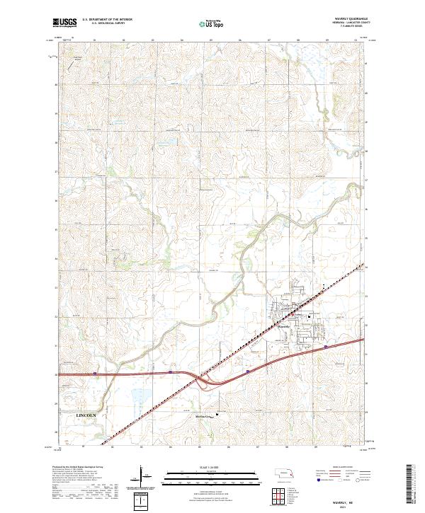
2021 Map of Waverly
USGS Topo · Published 2021About this map
Waverly and its surrounding agricultural landscape are defined by the winding course of Salt Creek, which cuts through the heart of this Lancaster County quadrangle. The map reveals a transition between the expanding outskirts of Lincoln in the southwest and the established residential street grid of Waverly further northeast. Notable community landmarks include the Rose Hill Cem and Marian Center, while local aviation is represented by Hall-Feld Airport in the northwest corner.
Find a feature on this map
56 named features on this map. Tap any name to fly to it.
Don’t see what you’re looking for? This feature index may not catch every label — zoom into the map to look around manually.
Map Details
Editions of this 2021 Waverly Map
This is the sole edition of this map. No revisions or reprints were ever made.
Other maps of this area

1893 · Fremont
USGS Topo · 1:125,000

1896 · Fremont
USGS Topo · 1:125,000

1897 · Lincoln
USGS Topo · 1:125,000

1899 · Wahoo
USGS Topo · 1:125,000

1903 · Weeping Water
USGS Topo · 1:125,000

1929 · Weeping Water
USGS Topo · 1:125,000

1955 · Fremont
USGS Topo · 1:250,000

1955 · Lincoln
USGS Topo · 1:250,000

1957 · Fremont
USGS Topo · 1:250,000

1957 · Lincoln
USGS Topo · 1:250,000