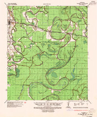
1935 Map of Waverly
USGS Topo · Published 1954About this map
Bayou Macon and the meandering Tensas River dominate this 1930s landscape, illustrating a complex network of waterways that defined life in Madison Parish. The Yazoo and Mississippi Valley railroad corridor serves as the primary east-west axis, connecting the settlements of Delhi, Waverly, Tendal, and Quebec. This era of the Mississippi Delta was characterized by an active river-based economy, evidenced by numerous landings such as Scott Ldg, Francis Ldg, and Butler Ldg along the bayous.
Find a feature on this map
45 named features on this map. Tap any name to fly to it.
Don’t see what you’re looking for? This feature index may not catch every label — zoom into the map to look around manually.
Map Details
Editions of this 1935 Waverly Map
2 editions found
Other maps of this area

1909 · Tallulah
USGS Topo · 1:24,000

1935 · Winnsboro
USGS Topo · 1:62,500

1935 · Baskinton
USGS Topo · 1:62,500

1935 · Hurricane
USGS Topo · 1:62,500

1935 · Waverly
USGS Topo · 1:62,500

1935 · Shackleford Lake
USGS Topo · 1:62,500

1939 · Talla Bena
USGS Topo · 1:62,500

1939 · Alsatia
USGS Topo · 1:62,500

1955 · Jackson
USGS Topo · 1:250,000

1958 · Baskinton
USGS Topo · 1:62,500