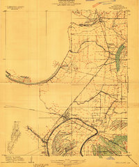
1909 Map of Tallulah
USGS Topo · Published 1909About this map
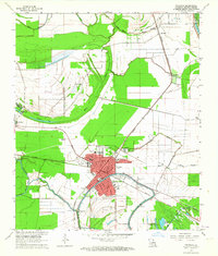
The hub of Tallulah serves as the focal point for this Madison Parish landscape, where the confluence of the St Louis Iron Mountain and Southern Railroad and the Vicksburg Shreveport and Pacific Railroad anchors the regional economy. The map illustrates a dense agricultural network dominated by named estates, including the Tallabena Plantation, Walnut Grove Plantation, and Shelby Plantation. These holdings are carved out among a complex system of waterways such as Walnut Bayou and Willow Bayou, showing how early 20th-century settlement followed the fertile ridges between bayous and sloughs. Scattered community life is evident in the placement of the Pleasant Grove Church and Zion Flower Church, providing a clear record of the rural social geography before modern development altered these plantation boundaries.
Find a feature on this map
42 named features on this map. Tap any name to fly to it.
Don’t see what you’re looking for? This feature index may not catch every label — zoom into the map to look around manually.
Map Details
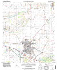
Editions of this 1909 Tallulah Map
This is the sole edition of this map. No revisions or reprints were ever made.
Historical Maps of Tallulah Through Time
9 maps found