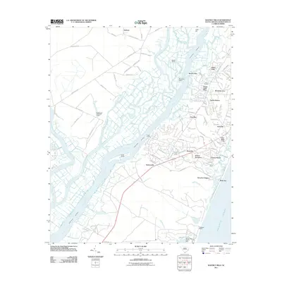
2011 Map of Waverly Mills
USGS Topo · Published 2011About this map
The Waccamaw River and Intracoastal Waterway define this coastal landscape, where the confluence with the Great Pee Dee River and Black River creates a complex network of islands and wetlands. Significant for local history, the map features established settlements like Waverly Mills and Simmonsville alongside newer residential enclaves such as Chapel Creek Villas and Pawleys Retreat. The presence of All Saints Cemetery and the Sea Gull Golf Course reflects a community shaped by both deep-rooted tradition and contemporary recreation.
Find a feature on this map
97 named features on this map. Tap any name to fly to it.
Don’t see what you’re looking for? This feature index may not catch every label — zoom into the map to look around manually.
Map Details
Editions of this 2011 Waverly Mills Map
This is the sole edition of this map. No revisions or reprints were ever made.
Other maps of this area

1942 · North Island
USGS Topo · 1:24,000

1942 · Magnolia Beach
USGS Topo · 1:24,000

1942 · Waverly Mills
USGS Topo · 1:24,000

1943 · Carvers Bay
USGS Topo · 1:24,000

1943 · Brookgreen
USGS Topo · 1:24,000

1943 · Plantersville
USGS Topo · 1:24,000

1943 · Georgetown North
USGS Topo · 1:24,000

1943 · Georgetown South
USGS Topo · 1:24,000

1947 · Georgetown South
USGS Topo · 1:24,000

1949 · Georgetown
USGS Topo · 1:250,000