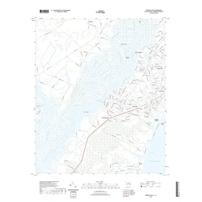
2020 Map of Waverly Mills
USGS Topo · Published 2020About this map
The complex deltaic landscape of Georgetown County is defined by the confluence of the Black River, Great Pee Dee River, and Waccamaw River. This network of waterways, joined by the Intracoastal Waterway and various shortcuts like Middleton Cut, creates a mosaic of low-lying islands such as Butler Island, Woodville Island, and Rabbit Island. To the west, the landscape transitions into the heavily wooded Longwater Swamp and Gatson Bay, while the eastern edge is marked by the developed shoreline of Pawleys Island and Debidue Beach along the Atlantic Ocean.
Find a feature on this map
166 named features on this map. Tap any name to fly to it.
Don’t see what you’re looking for? This feature index may not catch every label — zoom into the map to look around manually.
Map Details
Editions of this 2020 Waverly Mills Map
This is the sole edition of this map. No revisions or reprints were ever made.
Other maps of this area

1942 · North Island
USGS Topo · 1:24,000

1942 · Magnolia Beach
USGS Topo · 1:24,000

1942 · Waverly Mills
USGS Topo · 1:24,000

1943 · Carvers Bay
USGS Topo · 1:24,000

1943 · Brookgreen
USGS Topo · 1:24,000

1943 · Plantersville
USGS Topo · 1:24,000

1943 · Georgetown North
USGS Topo · 1:24,000

1943 · Georgetown South
USGS Topo · 1:24,000

1947 · Georgetown South
USGS Topo · 1:24,000

1949 · Georgetown
USGS Topo · 1:250,000