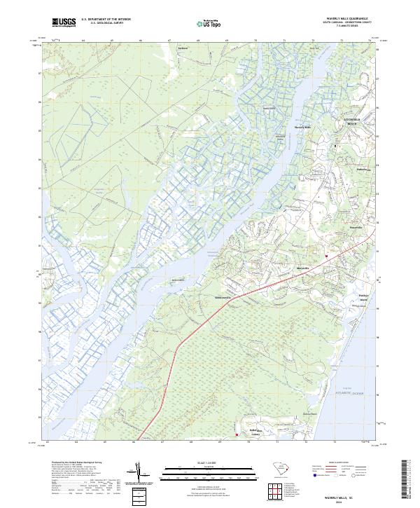
2024 Map of Waverly Mills
USGS Topo · Published 2024About this map
The Waccamaw National Wildlife Refuge and the intricate river systems of the South Carolina Lowcountry dominate this coastal landscape. The transition from the Great Pee Dee River and Black River into the Waccamaw River reveals a complex network of wetlands, featuring landmarks such as Rabbit Island and Woodville Island. This area preserves the historical footprint of the rice-planting era, where coastal settlements like Waverly Mills and Litchfield Beach sit alongside the winding Intracoastal Waterway.
Find a feature on this map
44 named features on this map. Tap any name to fly to it.
Don’t see what you’re looking for? This feature index may not catch every label — zoom into the map to look around manually.
Map Details
Editions of this 2024 Waverly Mills Map
This is the sole edition of this map. No revisions or reprints were ever made.
Other maps of this area

1942 · North Island
USGS Topo · 1:24,000

1942 · Magnolia Beach
USGS Topo · 1:24,000

1942 · Waverly Mills
USGS Topo · 1:24,000

1943 · Carvers Bay
USGS Topo · 1:24,000

1943 · Brookgreen
USGS Topo · 1:24,000

1943 · Plantersville
USGS Topo · 1:24,000

1943 · Georgetown North
USGS Topo · 1:24,000

1943 · Georgetown South
USGS Topo · 1:24,000

1947 · Georgetown South
USGS Topo · 1:24,000

1949 · Georgetown
USGS Topo · 1:250,000