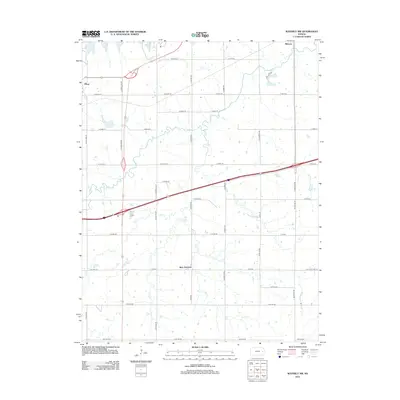
2012 Map of Waverly NW
USGS Topo · Published 2012About this map
Olivet and Melvern anchor the northern reaches of this rural Osage County landscape, where the waters of Melvern Lake extend into the upper corners of the quadrangle. The terrain is defined by a dense network of creek drainages, including the meandering paths of Frog Cr, Joe Cr, and Sand Cr, which cut through the agricultural grid. This area reflects a mid-continent crossroads at Beto Junction, where modern highway travel intersects with the older routes of the prairie. Local history and transportation evolution are visible through the alignment of Old Hwy 50 and Old State Hwy 50, tracing the legacy of early transcontinental travel across Kansas. The map's detailed grid of township roads, such as Native Rd NE and S Jordan Rd, provides a precise framework for locating former homesites and family farms in this traditional farming region.
Find a feature on this map
48 named features on this map. Tap any name to fly to it.
Don’t see what you’re looking for? This feature index may not catch every label — zoom into the map to look around manually.
Map Details
Editions of this 2012 Waverly NW Map
This is the sole edition of this map. No revisions or reprints were ever made.
Other maps of this area

1885 · Burlington
USGS Topo · 1:125,000

1889 · Burlingame
USGS Topo · 1:125,000

1894 · Burlingame
USGS Topo · 1:125,000

1894 · Burlington
USGS Topo · 1:125,000

1947 · Lawrence
USGS Topo · 1:250,000

1950 · Lawrence
USGS Topo · 1:250,000

1956 · Lawrence
USGS Topo · 1:250,000

1957 · Lebo
USGS Topo · 1:24,000

1957 · Waverly NW
USGS Topo · 1:24,000

1957 · Waverly
USGS Topo · 1:24,000