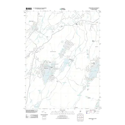
2011 Map of Wawayanda
USGS Topo · Published 2011About this map
Highland Lakes and the sprawling residential communities around Wawayanda Lake dominate the central landscape of this 2011 survey. The region is defined by a dense network of mountain lakes and small settlements that speak to its character as a premier mid-century and modern recreational retreat. To the north, the terrain transitions into a more agricultural and rural pattern around New Milford and Cutler Farms, where the winding Wawayanda Creek and Double Kill drain the valleys.
Find a feature on this map
170 named features on this map. Tap any name to fly to it.
Don’t see what you’re looking for? This feature index may not catch every label — zoom into the map to look around manually.
Map Details
Editions of this 2011 Wawayanda Map
This is the sole edition of this map. No revisions or reprints were ever made.
Other maps of this area

1888 · Franklin
USGS Topo · 1:62,500

1891 · Greenwood Lake
USGS Topo · 1:62,500

1893 · Greenwood Lake
USGS Topo · 1:62,500

1894 · Franklin
USGS Topo · 1:62,500

1897 · Franklin
USGS Topo · 1:62,500

1903 · Franklin Furnace
USGS Topo · 1:62,500

1903 · Greenwood Lake
USGS Topo · 1:62,500

1906 · Port Jervis
USGS Topo · 1:62,500

1906 · Goshen
USGS Topo · 1:62,500

1908 · Goshen
USGS Topo · 1:62,500