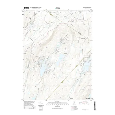
2014 Map of Wawayanda
USGS Topo · Published 2014About this map
Wawayanda Lake and the high ridges of Wawayanda Mtn dominate this 2014 survey of the borderlands between New York and New Jersey. The landscape is defined by its significant water bodies, from the expansive Upper Greenwood Lake and Highland Lake to the industrial-scale Canistear Reservoir in the south. The settlement pattern shows a distinct shift from the valley floors near Vernon and New Milford to the lakeside communities of Kampe, Moe, and Uttertown. Local history is preserved at the Glenwood Cem and within the narrow drainage corridors of Pochuck Creek and Black Creek. The map documents the persistent rural-residential character of the Sussex Co and Passaic Co highlands, where steep terrain like Bearfort Mtn has historically limited dense development to specific basins and transit routes like RT-94.
Find a feature on this map
54 named features on this map. Tap any name to fly to it.
Don’t see what you’re looking for? This feature index may not catch every label — zoom into the map to look around manually.
Map Details
Editions of this 2014 Wawayanda Map
This is the sole edition of this map. No revisions or reprints were ever made.
Other maps of this area

1888 · Franklin
USGS Topo · 1:62,500

1891 · Greenwood Lake
USGS Topo · 1:62,500

1893 · Greenwood Lake
USGS Topo · 1:62,500

1894 · Franklin
USGS Topo · 1:62,500

1897 · Franklin
USGS Topo · 1:62,500

1903 · Franklin Furnace
USGS Topo · 1:62,500

1903 · Greenwood Lake
USGS Topo · 1:62,500

1906 · Port Jervis
USGS Topo · 1:62,500

1906 · Goshen
USGS Topo · 1:62,500

1908 · Goshen
USGS Topo · 1:62,500