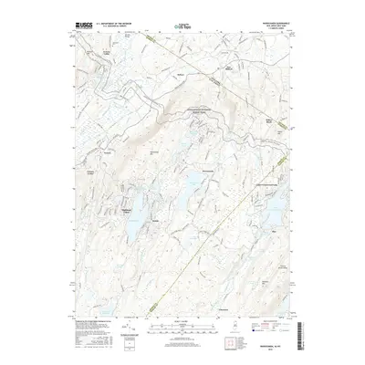
2016 Map of Wawayanda
USGS Topo · Published 2016About this map
Vernon Valley and the surrounding highlands of Sussex and Passaic counties are defined by a complex network of glacial lakes and the crossing of the Appalachian National Scenic Trail. The landscape transitions from the agricultural lowlands of the Pochuck Creek valley in the north to the dense, water-rich ridge-and-valley terrain of the south. This area includes significant residential and recreational lakeside developments such as Highland Lakes, Lake Wanda, and the extensive Upper Greenwood Lake.
Find a feature on this map
173 named features on this map. Tap any name to fly to it.
Don’t see what you’re looking for? This feature index may not catch every label — zoom into the map to look around manually.
Map Details
Editions of this 2016 Wawayanda Map
This is the sole edition of this map. No revisions or reprints were ever made.
Other maps of this area

1888 · Franklin
USGS Topo · 1:62,500

1891 · Greenwood Lake
USGS Topo · 1:62,500

1893 · Greenwood Lake
USGS Topo · 1:62,500

1894 · Franklin
USGS Topo · 1:62,500

1897 · Franklin
USGS Topo · 1:62,500

1903 · Franklin Furnace
USGS Topo · 1:62,500

1903 · Greenwood Lake
USGS Topo · 1:62,500

1906 · Port Jervis
USGS Topo · 1:62,500

1906 · Goshen
USGS Topo · 1:62,500

1908 · Goshen
USGS Topo · 1:62,500