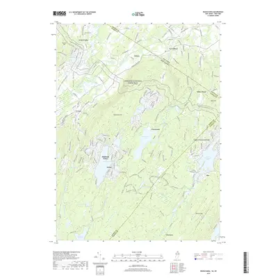
2019 Map of Wawayanda
USGS Topo · Published 2019About this map
The Appalachian National Scenic Trail traverses the high ridges of Wawayanda Mtn and Pochuck Mtn in this cross-border survey of the New York-New Jersey line. The landscape is defined by its dramatic relief, where the valley settlements of Vernon Valley and DeKays sit hundreds of feet below the lake-dotted highlands. Large water bodies like Wawayanda Lake and the residential clusters around Highland Lakes and Upper Greenwood Lake suggest a region shaped by both natural basins and planned recreational developments.
Find a feature on this map
178 named features on this map. Tap any name to fly to it.
Don’t see what you’re looking for? This feature index may not catch every label — zoom into the map to look around manually.
Map Details
Editions of this 2019 Wawayanda Map
This is the sole edition of this map. No revisions or reprints were ever made.
Other maps of this area

1888 · Franklin
USGS Topo · 1:62,500

1891 · Greenwood Lake
USGS Topo · 1:62,500

1893 · Greenwood Lake
USGS Topo · 1:62,500

1894 · Franklin
USGS Topo · 1:62,500

1897 · Franklin
USGS Topo · 1:62,500

1903 · Franklin Furnace
USGS Topo · 1:62,500

1903 · Greenwood Lake
USGS Topo · 1:62,500

1906 · Port Jervis
USGS Topo · 1:62,500

1906 · Goshen
USGS Topo · 1:62,500

1908 · Goshen
USGS Topo · 1:62,500