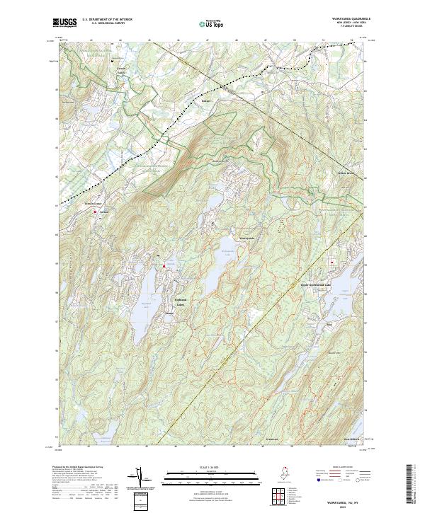
2023 Map of Wawayanda
USGS Topo · Published 2023About this map
Appalachian National Scenic Trail winds through the high ridges of the Hamburg Mountains and Wawayanda Mtn, providing a continuous corridor of protected landscape along the New Jersey and New York border. This modern survey illustrates the dense concentration of lake-centered settlements that characterize the area, including Highland Lakes, Upper Greenwood Lake, and the smaller communities of Kampe and East Highland Lake.
Find a feature on this map
181 named features on this map. Tap any name to fly to it.
Don’t see what you’re looking for? This feature index may not catch every label — zoom into the map to look around manually.
Map Details
Editions of this 2023 Wawayanda Map
This is the sole edition of this map. No revisions or reprints were ever made.
Other maps of this area

1888 · Franklin
USGS Topo · 1:62,500

1891 · Greenwood Lake
USGS Topo · 1:62,500

1893 · Greenwood Lake
USGS Topo · 1:62,500

1894 · Franklin
USGS Topo · 1:62,500

1897 · Franklin
USGS Topo · 1:62,500

1903 · Franklin Furnace
USGS Topo · 1:62,500

1903 · Greenwood Lake
USGS Topo · 1:62,500

1906 · Port Jervis
USGS Topo · 1:62,500

1906 · Goshen
USGS Topo · 1:62,500

1908 · Goshen
USGS Topo · 1:62,500