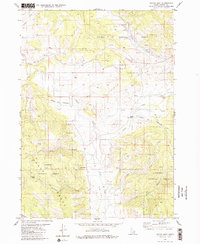
1980 Map of Wayan East
USGS Topo · Published 1980About this map
The Emigrant Trail (Lander Cutoff) cuts across this high-country landscape, providing a clear window into the historic migration routes that traversed the Caribou Range. This portion of the trail is marked by significant landmarks including Lanes Grave and another isolated Grave, grounding the overland journey in its human reality. Located within the Caribou National Forest, the region is characterized by a seasonal dairy economy, evidenced by the presence of Upper Dairy, Middle Dairy, and Lower Dairy.
Find a feature on this map
23 named features on this map. Tap any name to fly to it.
Don’t see what you’re looking for? This feature index may not catch every label — zoom into the map to look around manually.
Map Details
Editions of this 1980 Wayan East Map
2 editions found
Other maps of this area

1915 · Freedom
USGS Topo · 1:62,500

1915 · Lanes Creek
USGS Topo · 1:62,500

1932 · Irwin
USGS Topo · 1:96,000

1935 · Irwin
USGS Topo · 1:125,000

1949 · Lower Valley
USGS Topo · 1:24,000

1951 · Lower Valley
USGS Topo · 1:24,000
1951 · Upper Valley
USGS Topo · 1:24,000

1955 · Driggs
USGS Topo · 1:250,000

1955 · Preston
USGS Topo · 1:250,000

1958 · Driggs
USGS Topo · 1:250,000