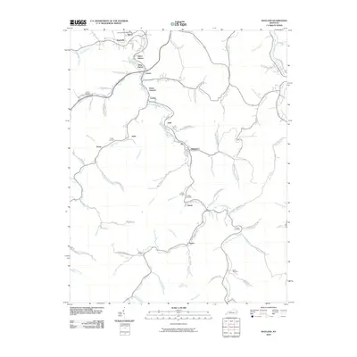
2010 Map of Wayland
USGS Topo · Published 2010About this map
Right Fork Beaver Creek and its many winding tributaries define the settlement patterns of this eastern Kentucky mountain landscape. In the early 21st century, the narrow valley floors are home to a dense sequence of communities such as Hueysville, Garrett, Lackey, and Wayland. These towns are connected by the valley corridors, where transportation and infrastructure like the Hueysville Post Office and Porter Junction support the local population. The topography is deeply etched by water, with Mill Creek, Caney Fork, and Jones Fork creating the steep-walled hollows typical of the region.
Find a feature on this map
82 named features on this map. Tap any name to fly to it.
Don’t see what you’re looking for? This feature index may not catch every label — zoom into the map to look around manually.
Map Details
Editions of this 2010 Wayland Map
This is the sole edition of this map. No revisions or reprints were ever made.
Other maps of this area

1886 · Prestonsburg
USGS Topo · 1:125,000

1890 · Whitesburg
USGS Topo · 1:125,000

1892 · Whitesburg
USGS Topo · 1:125,000

1892 · Prestonsburg
USGS Topo · 1:125,000

1912 · Hindman
USGS Topo · 1:48,000

1914 · Laynesville
USGS Topo · 1:48,000

1914 · Vergie
USGS Topo · 1:48,000

1915 · Prestonsburg
USGS Topo · 1:62,500

1915 · Hindman
USGS Topo · 1:62,500

1916 · Harold
USGS Topo · 1:62,500