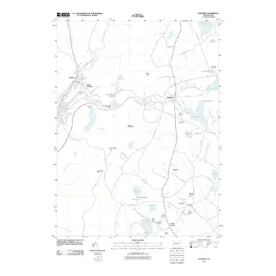
2010 Map of Waymart
USGS Topo · Published 2010About this map
The Moosic Mountains dominate the central landscape of this survey, dividing the industrial history of the Lackawanna River valley from the high plateau lakes of Wayne County. In the west, the settlement of Simpson and the Belmont Reservoir represent the managed water resources of the coal region, while the eastern half reveals a summer recreation and agricultural economy. The borough of Waymart serves as a local hub near Lake Ladore and the historic Owego Tpke. Genealogists and local historians will find significant detail in the three burial grounds—Old Canaan Cemetery, East Canaan Cemetery, and South Canaan Cemetery—situated near the southern community of South Canaan. Traces of small-scale industry persist through features like the Machell Mill Dam, while modern aviation is represented by the Flying Fox Airport and the Kellachow Landing Strip.
Find a feature on this map
79 named features on this map. Tap any name to fly to it.
Don’t see what you’re looking for? This feature index may not catch every label — zoom into the map to look around manually.
Map Details
Editions of this 2010 Waymart Map
This is the sole edition of this map. No revisions or reprints were ever made.
Other maps of this area

1889 · Scranton
USGS Topo · 1:62,500

1891 · Scranton
USGS Topo · 1:62,500

1892 · Honesdale
USGS Topo · 1:62,500

1892 · Dundaff
USGS Topo · 1:62,500

1893 · Scranton
USGS Topo · 1:62,500

1928 · Ariel
USGS Topo · 1:62,500

1932 · Ariel
USGS Topo · 1:62,500

1943 · Scranton
USGS Topo · 1:125,000

1943 · Honesdale
USGS Topo · 1:125,000

1946 · Olyphant
USGS Topo · 1:24,000
Featured Places
- Carbondale, PA
- Waymart, PA
- South Canaan Township, PA
- Carbondale Township, PA
- Whites Crossing, Carbondale Township