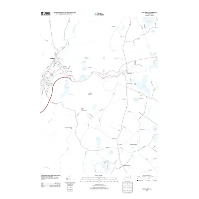
2013 Map of Waymart
USGS Topo · Published 2013About this map
The Moosic Mountains dominate the central landscape of this Wayne and Lackawanna County region, framing a transition from industrial river valleys to upland recreational lakes. To the west, the Lackawanna River flows through Simpson and Whites Crossing, where the dense residential street grids of Archbald St and Cemetery St reflect the area’s historic development. The central highlands are defined by a complex network of water management, including the Carbondale Number Four Reservoir and Brownell Reservoir, positioned along Racket Brook. Moving east, the terrain shifts into a pastoral and resort-focused layout centered on Waymart and the sprawling waters of Lake Ladore. This survey documents a landscape of high-elevation points like High Knob and Salem Hill, where the Salem Firetower stands as a sentinel over the surrounding ridges.
Find a feature on this map
116 named features on this map. Tap any name to fly to it.
Don’t see what you’re looking for? This feature index may not catch every label — zoom into the map to look around manually.
Map Details
Editions of this 2013 Waymart Map
This is the sole edition of this map. No revisions or reprints were ever made.
Other maps of this area

1889 · Scranton
USGS Topo · 1:62,500

1891 · Scranton
USGS Topo · 1:62,500

1892 · Honesdale
USGS Topo · 1:62,500

1892 · Dundaff
USGS Topo · 1:62,500

1893 · Scranton
USGS Topo · 1:62,500

1928 · Ariel
USGS Topo · 1:62,500

1932 · Ariel
USGS Topo · 1:62,500

1943 · Scranton
USGS Topo · 1:125,000

1943 · Honesdale
USGS Topo · 1:125,000

1946 · Olyphant
USGS Topo · 1:24,000
Featured Places
- Carbondale, PA
- Waymart, PA
- South Canaan Township, PA
- Carbondale Township, PA
- Whites Crossing, Carbondale Township