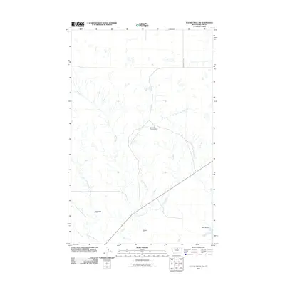
2011 Map of Wayne Creek NW
USGS Topo · Published 2011About this map
Reddenbacks Ranch sits in the southwest corner of this Montana landscape, where the headwaters of the Wayne Creek system converge. The drainage is defined by several distinct branches, including the West Fork, South Fork, and the winding East Fork Wayne Creek. This semi-arid ranching country in Blaine County relies on small-scale water management, evidenced by the Old Woman Reservoir Dam and Meadow Dam.
Find a feature on this map
10 named features on this map. Tap any name to fly to it.
Don’t see what you’re looking for? This feature index may not catch every label — zoom into the map to look around manually.
Map Details
Editions of this 2011 Wayne Creek NW Map
This is the sole edition of this map. No revisions or reprints were ever made.
Other maps of this area

1903 · Wayne Creek
USGS Topo · 1:62,500

1905 · Wayne Creek
USGS Topo · 1:62,500

1905 · Harlem
USGS Topo · 1:62,500

1913 · Cherry Ridge
USGS Topo · 1:125,000

1953 · Havre
USGS Topo · 1:250,000

1957 · Havre
USGS Topo · 1:250,000

1958 · Havre
USGS Topo · 1:250,000

1964 · Wayne Creek SE
USGS Topo · 1:24,000
1964 · Grable Coulee
USGS Topo · 1:24,000
1964 · Harlem
USGS Topo · 1:24,000