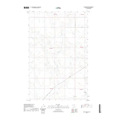
2020 Map of Wayne Creek NW
USGS Topo · Published 2020About this map
Wayne Cr and its complex network of seasonal tributaries define this section of Blaine County, Montana. The drainage patterns of the E Fork Wayne Cr and W Fork Wayne Cr cut through the high plains, creating a landscape of coulees and ravines. Evidence of the region’s sparse, rural infrastructure is found along the diagonal route of Turner Rd, which serves as a primary corridor through these expansive ranch lands. The map details the subtle topography of the northern plains, where features like Murray Coulee and Aveil Ravine provide the only major relief in the terrain. In the southern reaches, Harts Coulee and the headwaters of W Savoy Cr highlight the vital role of water management in this arid environment.
Find a feature on this map
16 named features on this map. Tap any name to fly to it.
Don’t see what you’re looking for? This feature index may not catch every label — zoom into the map to look around manually.
Map Details
Editions of this 2020 Wayne Creek NW Map
This is the sole edition of this map. No revisions or reprints were ever made.
Other maps of this area

1903 · Wayne Creek
USGS Topo · 1:62,500

1905 · Wayne Creek
USGS Topo · 1:62,500

1905 · Harlem
USGS Topo · 1:62,500

1913 · Cherry Ridge
USGS Topo · 1:125,000

1953 · Havre
USGS Topo · 1:250,000

1957 · Havre
USGS Topo · 1:250,000

1958 · Havre
USGS Topo · 1:250,000

1964 · Wayne Creek SE
USGS Topo · 1:24,000
1964 · Grable Coulee
USGS Topo · 1:24,000
1964 · Harlem
USGS Topo · 1:24,000