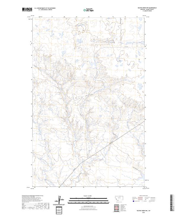
2024 Map of Wayne Creek NW
USGS Topo · Published 2024About this map
Wayne Creek and its many branches form the primary drainage system for this high plains landscape in Blaine County. The map illustrates a complex network of seasonal and perennial watercourses, including the East Fork Wayne Creek, West Fork Wayne Creek, and South Fork Wayne Creek. These tributaries converge as they move through the township sections, creating a distinctive dendritic pattern across the terrain.
Find a feature on this map
15 named features on this map. Tap any name to fly to it.
Don’t see what you’re looking for? This feature index may not catch every label — zoom into the map to look around manually.
Map Details
Editions of this 2024 Wayne Creek NW Map
This is the sole edition of this map. No revisions or reprints were ever made.
Other maps of this area

1903 · Wayne Creek
USGS Topo · 1:62,500

1905 · Wayne Creek
USGS Topo · 1:62,500

1905 · Harlem
USGS Topo · 1:62,500

1913 · Cherry Ridge
USGS Topo · 1:125,000

1953 · Havre
USGS Topo · 1:250,000

1957 · Havre
USGS Topo · 1:250,000

1958 · Havre
USGS Topo · 1:250,000

1964 · Wayne Creek SE
USGS Topo · 1:24,000
1964 · Grable Coulee
USGS Topo · 1:24,000
1964 · Harlem
USGS Topo · 1:24,000