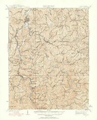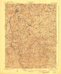
1909 Map of Wayne
USGS Topo · Published 1932About this map
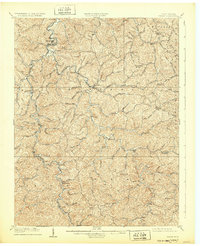
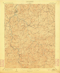
Twelvepole Creek and its winding tributaries dictate the life of Wayne County at the turn of the century, carving deep valleys through the Appalachian hills. This 1907 survey, reprinted in the early 1930s, shows a landscape defined by the Norfolk and Western RR, which follows the water level through settlements like Genoa, Radnor, and Dunlow. The map captures a critical era for genealogists, recording isolated post offices such as Quaker PO and Sidney PO that served rural ridge-top and hollow communities. Local administration is anchored by the County Farm near the northern bend of the creek. From the high points of Turkeycamp Knob and Squirrel Knob down to the creek forks at East Lynn, the topography reveals a dense network of family-named hollows and branches, documenting the early industrial and agricultural footprint of western West Virginia before modern highway expansion.
Find a feature on this map
95 named features on this map. Tap any name to fly to it.
Don’t see what you’re looking for? This feature index may not catch every label — zoom into the map to look around manually.
Map Details
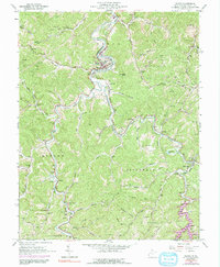
Editions of this 1909 Wayne Map
2 editions found
Historical Maps of Wayne Through Time
5 maps found