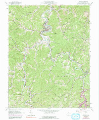
1962 Map of Wayne
USGS Topo · Published 1991About this map
Twelvepole Creek meanders through the heart of Wayne County, serving as the primary geographic corridor for the town of Wayne and its surrounding rural communities. During this era, the landscape is defined by a dense network of extraction, with numerous gas and oil wells dotting the hillsides from Genoa in the south to the northern reaches of the West Fork. The community’s social fabric is visible through its many local institutions, including Wayne High School and several rural schoolhouses like Twomile School and Big Branch School.
Find a feature on this map
83 named features on this map. Tap any name to fly to it.
Don’t see what you’re looking for? This feature index may not catch every label — zoom into the map to look around manually.
Map Details
Editions of this 1962 Wayne Map
3 editions found
Other maps of this area

1892 · Huntington
USGS Topo · 1:125,000

1898 · Huntington
USGS Topo · 1:125,000

1901 · Guyandot
USGS Topo · 1:62,500

1901 · Ceredo
USGS Topo · 1:62,500

1902 · Guyandot
USGS Topo · 1:62,500

1903 · Kenova
USGS Topo · 1:125,000

1904 · Kenova
USGS Topo · 1:125,000

1909 · Wayne
USGS Topo · 1:62,500

1911 · Louisa
USGS Topo · 1:48,000

1913 · Ceredo
USGS Topo · 1:62,500