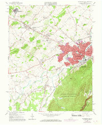
1964 Map of Waynesboro West
USGS Topo · Published 1968About this map
Waynesboro serves as the industrial and civic anchor of this mid-1960s landscape, positioned where the South River meets the rail intersection of the Chesapeake and Ohio and the Norfolk and Western railroads. The city's expansion is visible through established neighborhoods and educational centers like Rosenwald Sch and Wenonah Sch. To the west, the rural character of Augusta County is defined by legacy institutions and small communities, including the Woodrow Wilson Educational Center and the village of Fishersville.
Find a feature on this map
74 named features on this map. Tap any name to fly to it.
Don’t see what you’re looking for? This feature index may not catch every label — zoom into the map to look around manually.
Map Details
Editions of this 1964 Waynesboro West Map
2 editions found
Other maps of this area

1892 · Buckingham
USGS Topo · 1:125,000

1892 · Harrisonburg
USGS Topo · 1:125,000

1894 · Staunton
USGS Topo · 1:125,000

1894 · Lexington
USGS Topo · 1:125,000

1934 · Waynesboro
USGS Topo · 1:48,000

1936 · Vesuvius
USGS Topo · 1:48,000

1939 · Waynesboro
USGS Topo · 1:62,500

1941 · Vesuvius
USGS Topo · 1:62,500

1943 · Lovingston
USGS Topo · 1:62,500

1944 · Staunton
USGS Topo · 1:62,500