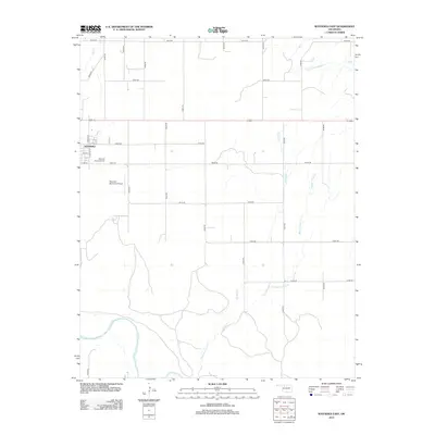
2012 Map of Waynoka East
USGS Topo · Published 2012About this map
Waynoka and its eastern agricultural surroundings are defined by a grid of rural roads and the meandering path of the Cimarron River in the southwest corner. This 2012 survey shows the settlement's core, where streets like Lincoln St and Elm St transition into the section-line road network. The landscape is carved by several drainages, including Walnut Grove Cr and Wildcat Cr, which flow toward the river basin. Notable civic landmarks include the Waynoka Municipal Cem and the Waynoka Municipal Airport, both situated on the outskirts of the primary township. The map illustrates the persistent structure of Oklahoma's land divisions, with numbered roads such as E0300 Rd and N2340 Rd providing access to the fertile plains between the creek beds.
Find a feature on this map
27 named features on this map. Tap any name to fly to it.
Don’t see what you’re looking for? This feature index may not catch every label — zoom into the map to look around manually.
Map Details
Editions of this 2012 Waynoka East Map
This is the sole edition of this map. No revisions or reprints were ever made.
Other maps of this area

1955 · Woodward
USGS Topo · 1:250,000

1958 · Woodward
USGS Topo · 1:250,000

1969 · Belva
USGS Topo · 1:24,000

1969 · Dacoma SW
USGS Topo · 1:24,000

1969 · Glass Mountains NW
USGS Topo · 1:24,000

1969 · Waynoka NW
USGS Topo · 1:24,000

1969 · Hopeton
USGS Topo · 1:24,000

1969 · Avard
USGS Topo · 1:24,000

1969 · Waynoka East
USGS Topo · 1:24,000

1969 · Togo
USGS Topo · 1:24,000