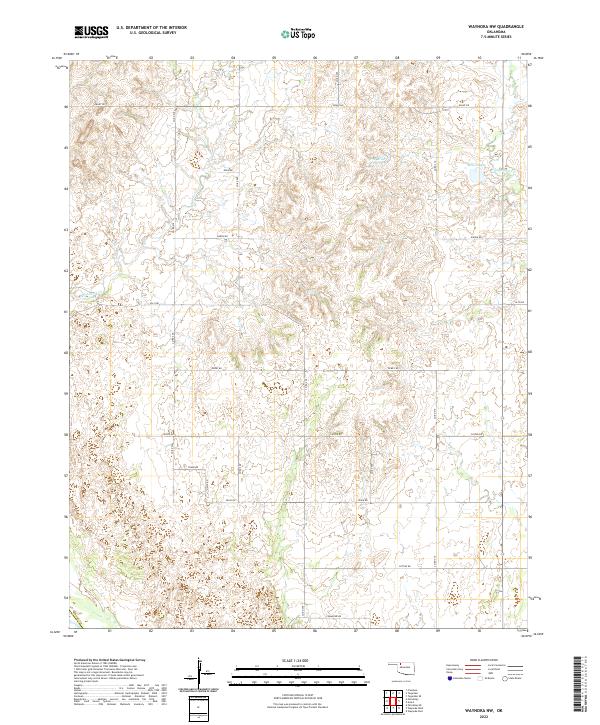
2022 Map of Waynoka NW
USGS Topo · Published 2022About this map
Rolling grasslands and agricultural plots in northwestern Oklahoma define this corner of Woods Co. The landscape is etched by several small waterways, most notably Whitehorse Creek and Eagle Chief Creek, which snake through the sectioned terrain. Man-made water features such as P M Miller Reservoir and McGill Lake suggest a managed hydrology typical of the region's ranching and farming operations. The map reveals the rigid adherence to the Public Land Survey System, with a dense grid of gravel and dirt roads like Grant Rd and Dewey Rd following section lines across the townships of T26N R17W and T26N R16W. This systematic division of the plains reflects a century of land use, where the expansive prairie was methodically partitioned into the production landscape seen in the 2020s.
Find a feature on this map
26 named features on this map. Tap any name to fly to it.
Don’t see what you’re looking for? This feature index may not catch every label — zoom into the map to look around manually.
Map Details
Editions of this 2022 Waynoka NW Map
This is the sole edition of this map. No revisions or reprints were ever made.
Other maps of this area

1955 · Woodward
USGS Topo · 1:250,000

1958 · Woodward
USGS Topo · 1:250,000

1969 · Tegarden SE
USGS Topo · 1:24,000

1969 · Waynoka NW
USGS Topo · 1:24,000

1969 · Avard
USGS Topo · 1:24,000

1969 · Waynoka East
USGS Topo · 1:24,000

1969 · Tegarden
USGS Topo · 1:24,000

1969 · Waynoka West
USGS Topo · 1:24,000

1970 · Fairvalley SE
USGS Topo · 1:24,000

1970 · Fairvalley
USGS Topo · 1:24,000