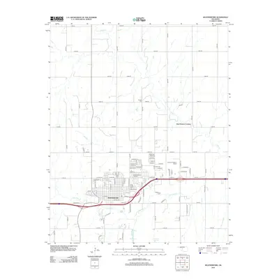
2012 Map of Weatherford
USGS Topo · Published 2012About this map
Weatherford dominates the landscape of Custer County in this 2012 survey, centered on the sprawling campus of Southwestern Oklahoma State Univ. The town's grid expands outward from the core, with residential and commercial streets such as W Main St and E Davis Ave providing the primary east-west structure. To the east, the Thomas P Stafford Airport marks a significant aeronautical landmark, while the surrounding rural lands are divided by a rigorous section-line road system.
Find a feature on this map
95 named features on this map. Tap any name to fly to it.
Don’t see what you’re looking for? This feature index may not catch every label — zoom into the map to look around manually.
Map Details
Editions of this 2012 Weatherford Map
This is the sole edition of this map. No revisions or reprints were ever made.
Other maps of this area

1955 · Clinton
USGS Topo · 1:250,000

1956 · Cordell
USGS Topo · 1:62,500

1957 · Clinton
USGS Topo · 1:250,000

1957 · Clinton
USGS Topo · 1:62,500

1961 · Eakly
USGS Topo · 1:62,500

1964 · Weatherford
USGS Topo · 1:62,500

1976 · Clinton SE
USGS Topo · 1:24,000

1976 · Clinton NE
USGS Topo · 1:24,000
1983 · Corn
USGS Topo · 1:24,000
1983 · Indianapolis
USGS Topo · 1:24,000