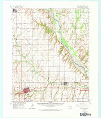
1976 Map of Clinton NE
USGS Topo · Published 1976About this map
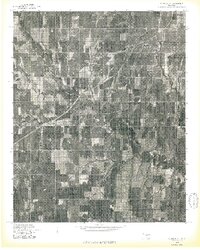
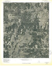
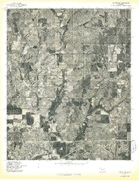
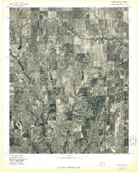
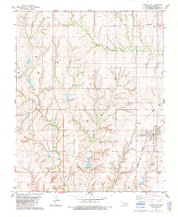
Thomas occupies the northeast corner of this 1976 orthophotoquad, showing a highly organized grid of agricultural fields and windbreaks typical of western Oklahoma. The landscape is defined by the winding course of Deer Creek, which cuts a drainage path through the center and eastern portions of the terrain. This specialized aerial-based survey highlights the mid-century land use patterns of Custer County, where large rectangular farm plots are punctuated by smaller structures and clusters of trees. Near the center-west edge of the sheet, the settlement of Foley serves as a small waypoint in this rural expanse. Unlike traditional topographic maps, this imagery reveals the actual density of vegetation and the precise location of homesteads and farm buildings as they stood in the mid-1970s.
Find a feature on this map
3 named features on this map. Tap any name to fly to it.
Don’t see what you’re looking for? This feature index may not catch every label — zoom into the map to look around manually.
Map Details
Editions of this 1976 Clinton NE Map
This is the sole edition of this map. No revisions or reprints were ever made.
Other maps of this area

1955 · Clinton
USGS Topo · 1:250,000

1957 · Clinton
USGS Topo · 1:250,000
1957 · Clinton
USGS Topo · 1:62,500
1962 · Putnam
USGS Topo · 1:62,500
1964 · Oakwood
USGS Topo · 1:62,500
1964 · Weatherford
USGS Topo · 1:62,500
1976 · Clinton SE
USGS Topo · 1:24,000
1976 · Clinton SW
USGS Topo · 1:24,000
1976 · Clinton NW
USGS Topo · 1:24,000
1983 · Custer City
USGS Topo · 1:24,000