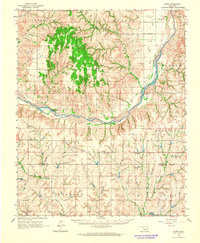
1976 Map of Clinton NW
USGS Topo · Published 1976About this map
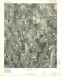
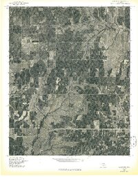
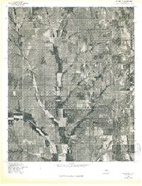
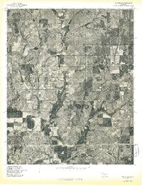
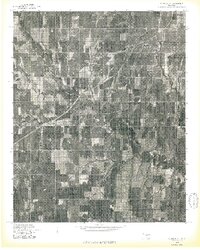
Agricultural patterns and the section-line grid of western Oklahoma are clearly defined in this orthophotoquad, which captures the landscape of Custer County in the mid-1970s. The settlement of Custer City sits in the southeastern quadrant, showing the dense concentration of structures and street layouts typical of rural trade centers during this era. Further north, the smaller community of Independence appears within a landscape dominated by terraced fields and the winding drainage patterns of local creek systems. This aerial perspective offers researchers a visual record of land use, ranching, and farmstead locations before modern developments or shifts in Oklahoma's rural population centers.
Find a feature on this map
2 named features on this map. Tap any name to fly to it.
Don’t see what you’re looking for? This feature index may not catch every label — zoom into the map to look around manually.
Map Details
Editions of this 1976 Clinton NW Map
This is the sole edition of this map. No revisions or reprints were ever made.
Other maps of this area

1955 · Clinton
USGS Topo · 1:250,000

1957 · Clinton
USGS Topo · 1:250,000
1957 · Butler
USGS Topo · 1:62,500
1957 · Clinton
USGS Topo · 1:62,500
1962 · Putnam
USGS Topo · 1:62,500
1962 · Aledo
USGS Topo · 1:62,500
1976 · Clinton SE
USGS Topo · 1:24,000
1976 · Butler NE
USGS Topo · 1:24,000
1976 · Clinton SW
USGS Topo · 1:24,000
1976 · Clinton NE
USGS Topo · 1:24,000