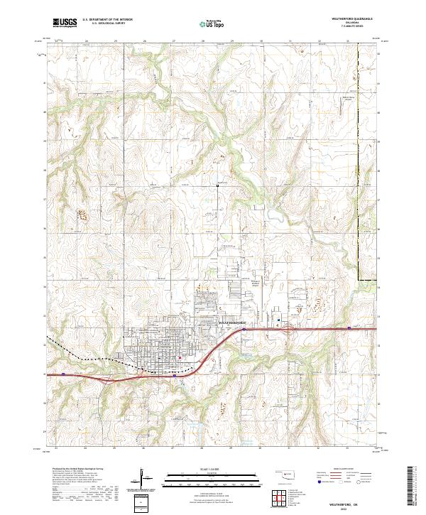
2022 Map of Weatherford
USGS Topo · Published 2022About this map
Southwestern Oklahoma State University serves as a central landmark in Weatherford, an area defined by its academic presence and its position along the historic Rte 66 Hwy. This western Oklahoma landscape is characterized by a grid of rural section roads, such as E0980 Rd and N2410 Rd, which connect outlying agricultural lands to the municipal center. The drainage patterns of Little Deep Cr and Deer Cr wind through the township lines of t13n r14w and t12n r14w, illustrating the transition from open range to developed townsite.
Find a feature on this map
103 named features on this map. Tap any name to fly to it.
Don’t see what you’re looking for? This feature index may not catch every label — zoom into the map to look around manually.
Map Details
Editions of this 2022 Weatherford Map
This is the sole edition of this map. No revisions or reprints were ever made.
Other maps of this area

1955 · Clinton
USGS Topo · 1:250,000

1956 · Cordell
USGS Topo · 1:62,500

1957 · Clinton
USGS Topo · 1:250,000

1957 · Clinton
USGS Topo · 1:62,500

1961 · Eakly
USGS Topo · 1:62,500

1964 · Weatherford
USGS Topo · 1:62,500

1976 · Clinton SE
USGS Topo · 1:24,000

1976 · Clinton NE
USGS Topo · 1:24,000
1983 · Corn
USGS Topo · 1:24,000
1983 · Indianapolis
USGS Topo · 1:24,000