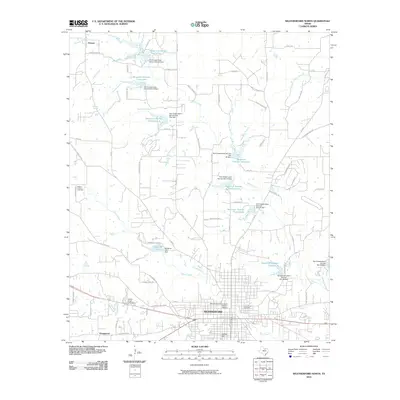
2010 Map of Weatherford North
USGS Topo · Published 2010About this map
The Weatherford Downtown Historic District serves as the focal point of this Parker County study, capturing the city's northward expansion during the first decade of the 2000s. The landscape is defined by a sophisticated system of water management, illustrated by numerous numbered reservoirs and dams established by the Soil Conservation Service, including Soil Conservation Service Site 24 Dam and Soil Conservation Service Site 30 Dam. These projects, situated along tributaries like Willow Creek and Town Creek, highlight the region's managed hydrology and suburban development.
Find a feature on this map
86 named features on this map. Tap any name to fly to it.
Don’t see what you’re looking for? This feature index may not catch every label — zoom into the map to look around manually.
Map Details
Editions of this 2010 Weatherford North Map
This is the sole edition of this map. No revisions or reprints were ever made.
Other maps of this area

1891 · Weatherford
USGS Topo · 1:125,000

1893 · Weatherford
USGS Topo · 1:125,000

1931 · Dennis
USGS Topo · 1:62,500

1932 · Springtown
USGS Topo · 1:62,500

1954 · Dallas
USGS Topo · 1:250,000

1958 · Dallas
USGS Topo · 1:250,000

1958 · Springtown
USGS Topo · 1:24,000
1959 · Lake Weatherford
USGS Topo · 1:24,000
1959 · Weatherford North
USGS Topo · 1:24,000
1959 · Brock
USGS Topo · 1:24,000