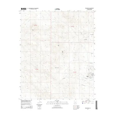
2014 Map of Weaver Peak
USGS Topo · Published 2014About this map
Weaver Peak and Rocky Boy Peak dominate this high-desert landscape within the Weaver Mountains of Yavapai County. The topography is defined by a series of steep drainages, including Poplar Wash, Cottonwood Cr, and the various forks of N Fork Date Cr, which carve through the arid terrain. The settlement of Peeples Valley occupies a pocket of relatively level ground in the southeast, characterized by a dense residential street grid including S Pioneer Ave and S Henley Ave. Outside of this localized development, the map shows a network of remote trails and ranch roads such as S Backwoods Trl and W Doublebar A Ranch Rd. The contrast between the organized residential planning of the valley and the surrounding undeveloped peaks reflects the classic rural Arizona pattern of high-altitude ranching and modern residential infill.
Find a feature on this map
34 named features on this map. Tap any name to fly to it.
Don’t see what you’re looking for? This feature index may not catch every label — zoom into the map to look around manually.
Map Details
Editions of this 2014 Weaver Peak Map
This is the sole edition of this map. No revisions or reprints were ever made.
Other maps of this area

1887 · Prescott
USGS Topo · 1:250,000

1892 · Prescott
USGS Topo · 1:250,000

1903 · Congress
USGS Topo · 1:125,000

1904 · Congress
USGS Topo · 1:125,000

1947 · Kirkland
USGS Topo · 1:62,500

1947 · Wagoner
USGS Topo · 1:62,500

1948 · Kirkland
USGS Topo · 1:63,360

1948 · Wagoner
USGS Topo · 1:63,360

1950 · Wagoner
USGS Topo · 1:62,500
1950 · Kirkland
USGS Topo · 1:62,500