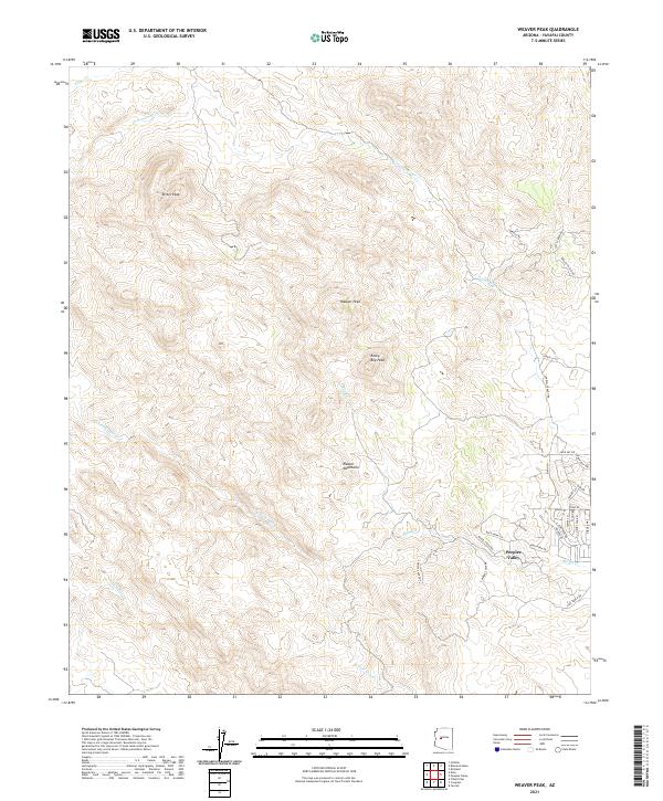
2021 Map of Weaver Peak
USGS Topo · Published 2021About this map
Peeples Valley serves as the primary residential anchor in this high-desert landscape of southwestern Yavapai County. The settlement is situated at the foot of the Weaver Mountains, where several seasonal watercourses such as Model Cr and N Fork Date Cr emerge from the steep eastern slopes. The terrain is dominated by prominent summits, including Weaver Peak, Ritter Peak, and the centrally located Rocky Boy Peak. Historically, the area reflects a transition from ranching and mining toward modern rural residential development, evidenced by the network of named roads like Sorrells Rd and Hays Ranch Rd. These routes provide access to the various forks of S Fork Date Cr and Cottonwood Cr, illustrating how human activity in this arid region remains tethered to the drainage patterns and mountain passes.
Find a feature on this map
37 named features on this map. Tap any name to fly to it.
Don’t see what you’re looking for? This feature index may not catch every label — zoom into the map to look around manually.
Map Details
Editions of this 2021 Weaver Peak Map
This is the sole edition of this map. No revisions or reprints were ever made.
Other maps of this area

1887 · Prescott
USGS Topo · 1:250,000

1892 · Prescott
USGS Topo · 1:250,000

1903 · Congress
USGS Topo · 1:125,000

1904 · Congress
USGS Topo · 1:125,000

1947 · Kirkland
USGS Topo · 1:62,500

1947 · Wagoner
USGS Topo · 1:62,500

1948 · Kirkland
USGS Topo · 1:63,360

1948 · Wagoner
USGS Topo · 1:63,360

1950 · Wagoner
USGS Topo · 1:62,500
1950 · Kirkland
USGS Topo · 1:62,500