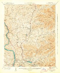
1943 Map of Weaverville
USGS Topo · Published 1943About this map
Weaverville and the northern outskirts of Asheville dominate this 1940s landscape, captured during a period of wartime growth in Buncombe County. The French Broad River carves a deep valley along the western edge, followed closely by the Southern railroad line through Alexander. The geography is defined by a dense network of family-named landmarks and rural institutions, from the Brittain Cove School to numerous small congregations like Rays Chapel and Mt Bethel Ch.
Find a feature on this map
64 named features on this map. Tap any name to fly to it.
Don’t see what you’re looking for? This feature index may not catch every label — zoom into the map to look around manually.
Map Details
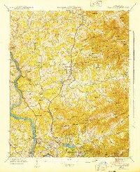
Editions of this 1943 Weaverville Map
2 editions found
Other maps of this area

1894 · Asheville
USGS Topo · 1:125,000

1900 · Mount Mitchell
USGS Topo · 1:125,000

1901 · Asheville
USGS Topo · 1:125,000

1902 · Mount Mitchell
USGS Topo · 1:125,000

1935 · Barnardsville
USGS Topo · 1:24,000

1935 · Craggy Pinnacle
USGS Topo · 1:24,000

1936 · Marshall
USGS Topo · 1:24,000

1936 · Enka
USGS Topo · 1:24,000

1936 · Weaverville
USGS Topo · 1:24,000

1936 · Mars Hill
USGS Topo · 1:24,000