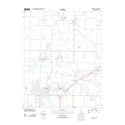
2011 Map of Webb City
USGS Topo · Published 2011About this map
Webb City and Carterville anchor this 2011 survey, showing the density of Jasper County’s northern corridor where residential streets meet the legacy of the regional mining landscape. The map reveals a high concentration of memorial sites for genealogists to explore, including the large Mount Hope Cemetery in the southwest and smaller historic plots like Weaver Cemetery, Friends Cemetery, and Laxton Cemetery. To the north, the smaller settlements of Purcell and Alba sit near the winding Spring River, while Oronogo occupies the western edge. This area reflects a mature transportation network, where local aviation at Cooper Flying Service Airport and the Joplin Municipal Airport complements the grid of rural roads and modern developments. The drainage of Center Creek and Bens Branch continues to shape the local geography as it moves through these established mining-era communities.
Find a feature on this map
58 named features on this map. Tap any name to fly to it.
Don’t see what you’re looking for? This feature index may not catch every label — zoom into the map to look around manually.
Map Details
Editions of this 2011 Webb City Map
This is the sole edition of this map. No revisions or reprints were ever made.
Other maps of this area

1886 · Joplin
USGS Topo · 1:125,000

1886 · Carthage
USGS Topo · 1:125,000

1894 · Joplin
USGS Topo · 1:125,000

1894 · Carthage
USGS Topo · 1:125,000

1945 · Pittsburg
USGS Topo · 1:62,500

1947 · Joplin
USGS Topo · 1:250,000

1947 · Pittsburg
USGS Topo · 1:62,500

1949 · Joplin
USGS Topo · 1:250,000

1950 · Pittsburg
USGS Topo · 1:62,500

1954 · Joplin
USGS Topo · 1:250,000